Thursday, July 31, 2014

Here for the Racing

So I have a confession. I've been a hiking slacker. Like, big time! I feel guilty. I feel anxiety ridden. Will I fail for a second summer in a row to complete the 48 4,000 footers? At least I have a semi-reasonable excuse...I think...

Racing. I've been doing it. A lot. Let's backtrack to a month ago when I completed the Loon Mountain Race. You can read all about it 3 posts ago. I felt a little like a slug, but an inspired slug.

The following week, July 12th, I competed in the Loon Monster Mud Run to defend my 1st place individual female crown. Technically speaking, I did just that. Yay! However, technically speaking I feel like I was really first runner up because another girl was a half a foot in front of me but was on a team, therefore placing 1st for Two Person Team. (Following pictures courtesy of Monster Mud Run Facebook page)

I started out clean...and totally heel running.

At this point I was much muddier than I was last year.
I felt like I was cheating with the smaller hose for females compared to the full size last year.

This race was not only important to me because I wanted to be the reigning champ, but because this is where the mister and I met a year prior. It was awesome seeing him at the finish line waiting for me again, but also knowing that throughout the race he was cheering me on (inside his head of course, he's so not the shout out loud type of person). Overall, I found this year to be more challenging then the year before. It felt like there was more crawling under things/between things/over things. Plus, the pond...don't even get me started. It was in the negative temps, or so it felt. I will say it woke up my muscles, even if I couldn't breath the entire journey across. Least. Favorite. Obstacle. EVER. There was also a timing issues where a girl ran the wrong heat, so I didn't get awarded 1st place at the award ceremony. I definitely think the event would benefit from timing chips, but I'm not in charge. It was also a bummer that there were only first place awards this year. Last year they had sweet swag and mud in a mason jar for 2nd and 3rd place finishers. However, I have this sitting in the living, so I'm happy.
Don't try to come after me. I now have 2 hatchets.

So I said I was feeling inspired after the Loon Mountain Run, right? The week after the Mud Run I attempted another mountain climb race at Cranmore put on by the White Mountain Milers. It was a fierce base to summit to base to summit to base race. I felt like I was an amateur. My shoelaces came untied about 4 times, so I lost quite a bit of time the first two times I stopped to tie them. I ended up finishing the race with one of my laces flying in the air. However, I was still really proud of myself for being the 8th overall woman to finish. It's amazing how many more males run these races than females because I was overall 61st. I tell you, I LOVED the downhill. There was a single track part that weaved through the woods and I felt like I was flying. I always do on single track, even when my running app tells me otherwise. It's peaceful to me. Well, except for when I can't get around someone. This race was well organized, had great snacks (mmm bagels), and the friendliest competitors around. People was congratulating one another and giving accolades around the finish line. Bonus, they didn't wait alllllll day to give out the awards. I felt like they valued the runner's time. I'm excited to run more of these next summer as I do the Mountain Goat Challenge.

So fast forward another weekend and you'll find me in Cleveland, Ohio. The boy and I went there so he could play in a golf tournament with one of his old college buddies (insert yawn). I did some negotiating (not really) and mentioned if I was going to sit around all day on a golf course that I wasn't even playing that I should be able to do something fun for me prior to the exciting golf tournament. Enter the Wigs for Kids Zoo 5k. Yes, you read that right. A 5k IN a zoo! Plus, it's for a great cause! Win-Win-Win (remember, the golf thing). Well, low and behold, Howard tested out his knee and he decided he was going to try to run, too. All on the 5 month anniversary of his major knee surgery. Yes, he ended up beating me by like 30 seconds too, let's not talk about that part though. Let's talk about the fact you're running through a zoo. The best part was finishing the race as the 3rd overall female and hearing all the people comment on how tough the "hill" was on the course. We're talking a 2 maybe 3% grade for a quarter mile. It was a nice addition in my opinion. Broke up the flatness. But, hey, this is the midwest where "hills" are far and few.
I heart elephants! Although it does remind me of my favorite read, The One and Only Ivan.
This race was reallllllly well organized. Clear course to follow as they had a person directing you at every corner, swag bags, LOADS of snacks (bagels, pasta, fruit, granola bars, cookies, so on and so forth), chip timers, great cause raising money for wigs for kids, and a zoo pass. I'd do it again in a heartbeat. In fact, I didn't really want to leave Ohio. I was having a blast biking in all the metroparks, gorging on delicious and artistic meals, taking in the sights, and shopping at the West Side Market. 

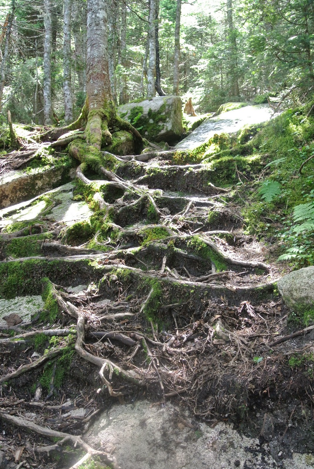
Alas, this trip (plus my week away next week) has left me in my state of panic about my hikes in the White Mountains. I mean, school is right around the corner no matter how in denial I am about it. Tomorrow is supposed to be gorgeous and we have plans to hike with some friends. It will be a redo of my very first 4,000 footer (ok, fine, my second, but are we really going to count when I did Mt. Washington in 7th Grade?). Report of Lafayette will be done in the very near future of next week. 

Happy trails whether you're hiking or running!


Monday, July 21, 2014

Surprise, Moriah! Bring a Bucket!

On Thursday the weather was begging me to get out and tackle another 4,000 footer. I responded with an enthusiastic, "Heck, Yeah!" and quickly packed my daypack. I traveled along 93N to the infamous "get me to the hiking trails" exit of Exit 35 for Route 3 North. Continued my path along Route 3, across 302, straight through until I turned right on Route 115 North for 9.7 miles until meeting up with Route 2 East which, eventually, lead me to Bangor Street on my right. I traveled to the end until I spied my destination: Carter-Moriah Trailhead. I parked along the side of the road and wondered how much the people who live on this cul-de-sac dislike the people who line their cars along the edges of their yards to hike.

I gathered my gear, laced up my sneakers, and headed towards the trail. I was surprised to uncover that this trail doesn't give a grace period. You immediately start heading uphill. I enjoyed the wider pathway, covered in pine needles, reminding me of my youth when we would go behind the school to conduct science observations on the nature trail. There were moments when the trail would flatten out and gracefully wind around the trees. The grade never felt too challenging and the first view-point of The Presidentials appeared rather quickly.


I took in the view for a few moments before continuing upon my way. As I glanced down I kicked myself for not bringing a container of some sort because between the view-point and Mount Surprise there's blueberries EVERYWHERE! Seriously, bring a container!

Nom, nom, nom
Now here's your warning: starting from this point the hike becomes rock slab. It's not difficult slab, but it's slab none-the-less and it requires your shoes to have some grip. Now I did wear a really old, falling apart pair of running sneakers for this hike and was fine on the way up except for one spot where I did have to have a friendly tree support my efforts. 

Rock Slabs for Days

Two miles into the hike after following cairns (that I failed to get a picture of) that have been strategically placed for your hiking needs, you'll find yourself standing on Mount Surprise. Stop here. Look at the view. Give your calves and hamstrings a rest. Pick some more blueberries. To get back on your way to the 4,000 footer look for a smallish opening in brush, jump down from the slab, and get ready for more slab and rugged terrain.

What comes after the slab

In addition to the more rocky terrain that you'll encounter after the slabs of Mount Surprise and before the summit of Moriah, you'll find mud. There were quite a few sections that required fancy footwork over stones or around the edges that were slightly hardened. So, don't wear your new fancy white shoes on this hike (or really any hike) but I'm sure you already knew that. 

There is this section that I LOVED going over and I dubbed it The Trail of Bridges. If you look closely you can see that those bridges extend around the corner as well. It reminded me of an obstacle course. 
Trail of Bridges

There was also this GIANT rock that was balancing on one side. I really wanted to try to climb it, but thought that probably wouldn't be the smartest idea. I couldn't get a great angle for the picture to do it justice, but then again, does a picture really ever do anything in nature justice? It's always more amazing to see with your own eyes, so go hike and see the giant rock. 

A Big Rock
Now, last week when I hiked the Tripyramids I talked about how the way down seemed to take F.O.R.E.V.E.R. This week, the ascent seemed like it would never end, which was odd because it's not that long of a hike. I kept looking up at the trees thinking, "The summit is around this bend, I know it!" But nope! Just more trail. I think it might have been on account of my stomach growling so loudly I thought an animal might come to check out what all the commotion was about, or that I did an hour yoga class before heading up. Anyway, I digress. 

Eventually, 4.5ish miles in, you'll come to the summit. There's a little sign letting you know to veer right, otherwise you'll be continuing on to Middle Carter. 

The summit has almost 360˚ views (there's trees to one side). It was a great place to stretch out, eat a Cliff Bar, rehydrate, and do some more yoga. You can see the Presidentials, Carters, and even into Maine on a clear day. 


I retraced my steps to descent the peak and found myself at my car before I even knew it. However, do be careful on the slabs on the way down. I did end up slipping a few times and giving myself a mini-heart attack. I definitely blame a lot of it on my shoe choice.

 Overall, it was a great hike with amazing views that didn't require a ton of effort. 

Distance: around 9 miles (my app quit on me!)
Time: 3.5 hours (Left at 11:35am, Returned at 3:03pm)
Trail: in and out on Carter-Moriah from the Bangor Road Trailhead in Gorham, NH

I love fungi!


Wednesday, July 16, 2014

I Tried the Pyramids

A long overdue post about my #35 and #36 4,000 footers. Like, a week overdue.

The day started off pretty hectic: indecision about which mountain to tackle, a car that refused to start, ants taking over the kitchen. Needless to say, I got a late start on my hike so decided to stay close to home and give the Tripyramids a go.

I parked over at Sabbaday Falls at 11:00am and headed a mile up Route 112 towards the Pine Bend Brook Trail. I decided to start the trek this way because 1) I didn't want to park my car on the side of the road 2) I wanted to end with a welcome sight of a waterfall without the knowledge of having to schlep a mile on the road to get to a car. It was a fairly uninteresting walk and was when I discovered my phone battery was low and I forgot my iPod (I know, very unnature-y of me to hike with a headphone in my ear, but it gets me going on those downhill runs).

I started up the Pine Bend Brook Trail, which was gradual and easy to follow thanks to a bunch of yellow blazes. Well, that was up until this point:

 Looks like you're supposed to go straight ahead, right?
       Well don't! Turn to your right and jump over the little brook. It has a little white marker on it. This is when I had the first inkling that this trail might be more like a 4,000 footer as opposed to the fairly easy ones I've been doing.

LEAP

A little ways beyond this point I rescued a dad wearing flip-flops, toting his young son as they looked for Sabbaday Falls. I think that exemplifies that the start of this hike was pretty casual (well, besides that  leap). Then things got a little more interesting. There's various brook/stream crossings that, at times, leaves you (or maybe it's just me) wondering if you're in fact going in the correct direction. Especially since the markers suddenly seem to be few. Don't fear! About 2.5 miles into the woods you'll start to go up: up rocks, up roots, up into the Sandwich Range.


Rock Scrambling                                   
Root Scrambling


3.2 Miles up you'll come to a junction for the Scaur Ridge Trail, which will be to your right. Continue on the Pine Bend Brook  Trail/Mt. Tripyramid Trail and in no time you'll arrive at a spot, with woods, and a couple rocks, and what looks like a place to tent. Jump to the left, over a rock (or take the little trail, but rock jumping is fun!) and behold, a VIEW from North Tripyramid. 

Don't let the bugs get the best of you, but if they do, just keep forging ahead towards the Sabbaday Brook Trail. The ridge line was runnable, which is exactly what I did. The half-mile to the next trail signage flew by (speaking of which, I saw these adorable robin eggs hiding out)


Continue straight past the sign for Sabbaday Brook Trail and go three-tenths of a mile UP to reach Middle Tripyramid. Here you'll get better views from two look-outs. 

                        This first shot (above) is facing south, towards Waterville Valley Ski Area, which is just as pretty in the summer. Go straight across the trail to face the north for this mountainous view (below).

I didn't stay too long on account of the black flies eating my flesh from the bone. I headed down happy that I got in a more challenging hike than I have been doing. Little did I know at that point what awaited me on the Sabbaday Brook Trail. 

Rock slabs were the first obstacle I encountered on my path back to my car. I didn't worry too much. Nothing my super, sticky approach shoes couldn't handle although my left knee wasn't very impressed with the extra pressure. Some points did require a squat/jump down, but again, nothing super out of the ordinary. But wait for it...

EROSION! That's what was really waiting for me like a person waiting on the the other side of a door ready to jump out and scare the piss out of me. All along the trail there's trees of varying sizes gracefully sprawled across the path. I felt like I was really prepping myself for my obstacle course race, weaving under, over, and between trunks to stay on route.
        This photo is just one of a gazillion I could've taken. At one point I had to use my skills to figure out which way the trail was as there were no markers that I could see and there were HUMONGOUS   trees down across a brook.  This occurred around an area that people camp in. Do not fear! Keep following the brook and you'll find the trails once again!
 Speaking of brooks...water completed the trifecta of the Tripyramids that made me long to know how much longer of the 4.9 miles I had left to conquer. I was NOT HAPPY at this point. I didn't even feel like running, as much as I wanted off of the mountain. This was definitely a THINKING hike. I had to think about where I was heading, where the trail might be, how to reconnect with it, and the best approach to get through the, what felt like, twenty brook crossings (it was probably really like 4 or 5). This is not a great hike for a newbie.
This isn't a great representation, but where all the water is flowing, that's the trail.

The descent felt like HOURS dragging by with no end in sight. However, there was a pretty amazing reward for when I did break through to the very populated Sabbaday Falls. 
It all felt worth it when I laid eyes on this gorgeous waterfall. It was just what my soul needed at that point, which made me ecstatic that my car was a mere .3 miles away in the parking lot. I patted myself on the back for planning this approach. I relaxed, breathed in the cool air, watched the families excitedly hum about the beauty that was in front of them. I did kick myself for not bringing my flip-flops as they would've helped with the crossings and it would've felt AH-MAZING to rest my tired, achey feet in the water. Alas, lessons for next time.

Overall the hike took me under 5 hours (11:04am-3:40pm) and is 11 miles long. 
It was moderate with some difficult spots.
Mostly wooded summits with look outs for a view (or two!)
Killer waterfall at the end which makes it worth it.
A million toads.

Until next time~

Monday, July 7, 2014

Loon Mountain Run...I'm a Goat!

So, there's this race series that perhaps you have heard of put on by the USATF called the New England Mountain Circuit. Essentially, you run 6 of the 7 races, become a mountain goat, and get a pass to run the Mount Washington Road Race the following year. I was going to become a mountain goat this year, but timing (as in time to train) and having an injured partner in crime put a delay in my plans. However, I wasn't going to skip all the races, especially with one within running distance of my summer home. Enter the Loon Mountain Race. 

Okay, I'll admit. I waffled. Like, a lot. Do I sign up? Do I wait until next year? Okay, I waffle with almost every decision I make, but that's a whole different post that could go on forever (or could it?) I chose to give it a try and see what I, personally, could do. After all, the Loon Mountain Race was hosting the US and Collegiate Mountain Championship. My competitive spirit took a back seat and I worked on competing with the only person that matters: myself. 

This race was intense! It starts at Parking Lot C by the river and weaves itself up the fire road, across the base of the mountain then up Brookway, back across to go up Speakeasy, then it's up, up, up to the gondola. My lungs and legs were having an argument the entire time. Either my breathing was labored or my legs were screaming. I'm working on getting them more in sync with one another. The good news was once you ran (or walked) by the cheering crowds by the gondola it was all downhill. No, literally, you run down Haulback. This was a great chance to catch my breath, gain some ground, and mentally prepare for the final challenge of this 4.8 course. 
There I am, trying not to chicken wing my way down the hill. 


So, the final challenge is what gives the Loon Mountain Race the reputation as one bad ass race: Upper Walking Boss. It's a 40% incline for a kilometer, which feels much, much longer at the end of a race as you're huffing and puffing to get to the finish line. I did take a second or two to glance behind me at the views of the mountains as I willed my legs to keep going up. Eventually, I made my way to the crest and could see the finish line.
I think I can, I think I can...

Even after passing the finish line I was thinking, "Wow, I'll never do this again. What was I thinking? This was torture!" After chilling out for a bit, then heading down to catch the gondola I changed my tune. I was proud of myself and felt pretty awesome that my day started off so productively. After checking out the results, I was even more proud of myself. I finished in an hour and ten minutes placing me in the top third for women and right on the halfway mark for my age division (33/65). I'd like to credit all the hikes I've been doing for my success, or maybe it was my super cute supporter waiting at the finish line. 

Are there any races you'd recommend? 


Tuesday, July 1, 2014

Hedgehog Mountain

The temps are announcing that summer as truly arrived and to me there's no better place to be than on the summit of a mountain. I mean, it's way cooler up there, there's often a lovely breeze, and the views...well I've already mentioned how I feel about those multiple times. 

Yesterday I didn't have enough time to go tackle one of my remaining 4,000 footers as I had an appointment with an amazingly friendly windshield repair man (seriously, I am so over road construction and the rocks that like to ninja kick my car!) but I digress.  Hence, I decided to take a nearby, relatively short 52 with a view: Hedgehog Mountain.

Situated right off the Kancamagus Highway in the Sandwich Range, it's easy to find (just look for the Downes Brook Trailhead sign), has a decent sized parking lot, and there's a reason it's on the 52 with a view list. You will need to have a WMNF parking pass, which if you don't have one you can pay there. Just make sure you have dollar bills on you.

I started off on the hike taking a left to follow the UNH Trail. The first quarter mile is relatively flat and makes for a nice leisurely walk, or jog, to warm up your legs. You'll pass an intersection where in the winter you can continue straight for x-country skiing trails or continue you hike by staying left and heading towards the East Ledges. The UNH trail has been rerouted but I found it incredibly easy to follow. Any time I questioned if I was on the right track, I would look up to see a yellow marker somewhere within view.  The trail had a few muddy sections, but nothing that couldn't be side stepped. Prior to getting to the ledges, the trail is covered with tree roots. I find roots to be visually pleasing, however, when I'm trying to jog up a mountain it can make for some interesting foot work.

Suddenly, the trail opened up to the East Ledges, and just WOW! I'm pretty sure I looked like the cheshire cat. I was reminded of my hometown mountain, Mount Major in Alton Bay, as I scrambled up ledges and took in the breath-taking scenery. 

There I am staring over the ledge to my certain death if I fell. 
Gorgeous, no?

Since it was such a gorgeous day I was really wishing I had a bathing suit on, a towel, a great read, and no appointment to get back to because I would've just sunbathed out on the ledges. There was the perfect breeze. However, that wasn't my reality so I trekked on
and back into the woods. There were these pretty spectacular rock formations that(spoiler alert) you eventually go onto to get to the summit.

I have a soft spot for nea


There was a group of kiddos from camp up there, so not much standing room to be had, but that was okay. I love seeing kids getting excited at the summit as it will, hopefully, make them life-long hikers/nature lovers. There's another ledge at the summit as well that was much quieter and still had views. 

Much quieter over here.


The other thing I love: loop hikes, which this one offers and is the easiest thing to follow. Just keep following the yellow markers down until you get to the junction with the option to go to the Kanc, which of course is where you're heading if you're done. There will be another junction in .3 miles to point you in the direction of the trailhead. From there, you're on your way to your car.

Overall, this was a great hike that offered great views for little effort. Overall total distance was 4.8 miles with a time of 1 hour 18 minutes. 

Happy trekking~