So I had alluded to the most epic hike I have taken thus far in my journey in the last post. Enter Labor Day weekend. The idea to do a loop with an overnight had been tossed out as an idea for this weekend a couple of times throughout the summer. Howard wasn't sure how his knee was going to feel, but he was on board IF it felt like it would hold up and not put too much strain on the healing process. Well he felt like he was up for the challenge and to be honest I really did need his support for a myriad of reasons, such as not knowing how to set up his tent (yes, I'm sure I could figure it out), being afraid of the dark (a big reason I don't want to go back packing alone), and the fact my brain loves to have visuals of a bear trying to eat me while I'm innocently laying in my tent, even when there's someone laying next to me. It would be so much worse as an individual. There's an odd comfort in thinking you'll be able to wake up someone else and let them know you're being viciously attacked.
Anyway, an overnight involving a loop, you say. YES! The plan was to hike Owlshead, Galehead, South Twin (although it technically didn't count for me because I had already done it), Zealand, and over to the Guyot campsite. The complete the hike over the bonds the following day. Well, the weather forecast was all, "I'm going to rain on you Sunday." To which we responded with, "Hey, we can go in the opposite direction ensuring views on Saturday." And that is what we did.
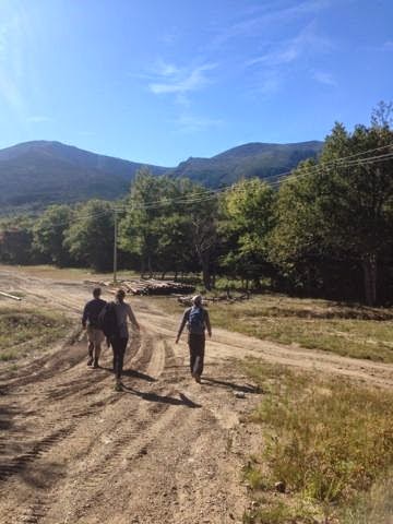
Enter Saturday morning. We had packed up all our gear Friday night and planned to leave for Lincoln Woods whenever we had finished getting ready (and I had gotten my coffee at White Mountain Bagel in Lincoln, of course!) I hadn't done any real research on this hike and left decisions/leading to Howard, which I might have failed to inform him of, but he did fine. We started out on the trail around 8:30am and immediately were turned into zombies due to the flat terrain that went on for miles. No, literally, miles. With 20+ pounds on our backs and a long day ahead we didn't run, which made it that much more painful when a couple without packs on passed by us. Howard looked over and told me for the twentieth time that we didn't need to overnight this, just run it. I told him to enjoy the hike and stop saying crazy things, especially with our unpredictable knees. Anyway, there was a lot of this:
and this:
We went right heading up Bondcliff Trail.
I felt like superwoman. Howard kept telling me to slow my roll as we had 20 miles to cover with the packs and if I kept speed hiking I would wear myself out. So logical. I was actually happy when the trail went from the dirt covered path to rocks.
Want slim, trim thighs but hate the stair master at the gym? Go on then, hike Bondcliff. You can run the start and then enjoy the rock stairs that take over for the next couple of miles.
At this point I was getting anxious to get to the ridge line. So many fellow hikers have told me tales of the beauty that are the Bonds. I was giddy like a school girl when we reached the scramble that signaled we were officially above treeline and about to hit our first summit.
My fellow hikers don't tell tales, or legends, or myths. I was in need of some Ritalin because I couldn't focus on just one thing. I kept looking all around being struck by the awesomeness in every direction. Of course I needed to get the famous cliff picture.
 |
| This is when I discovered why I always take the pictures, but it's still awesome. |
I forced Howard to get out there as well. I loathes getting his picture taken, but was a good sport. I ran around the top of Bondcliff snapping photos left and right, so excited to have made it in just four hours. It's truly beautiful up there and I could've spent an entire afternoon just chilling. The weather was absolute perfection.
We ate a snack, took in the views, picked up our packs and headed off to Bond. The trail was laden with various shaped and sized rocks, making it a little more technical then the trip up to Bondcliff. I lost my water bottle a couple of times because I haven't figured out which bottles should go in my pack (it's brand new as I've only backpacked once and that was in 7th grade!) I was surprised at the size of Bond as it's quite small at the summit, but again, the views made quite an impact. I could still see Loon Mountain, which makes me smile as it's our home ski mountain (which makes sense since we live 2 miles from it!)
Howard redeemed himself with this shot, but I also gave clear directions: get the cairn, get Bondcliff, get me. There's so much about this shot that makes me happy. It was a quick stop on Bond. We literally took this picture, looked at the summit marker, and then headed down again as we ventured on to West Bond.
West Bond quickly was upon us, although the sign faces the opposite direction from which we came, so I snuck my head around the tree just to make sure.
We dropped our packs in the woods and began to run. The trail was a little rocky at first as it took us down, but smoothed out until it was time to go up the summit.
 |
| It's a little rocky to get to the summit. |
|
|
But once you scale over the boulders that are not really boulders but are you're rewarded with views in every direction.
 |
| Yay for views! |
|
|
 |
| Summit #3 complete! Time to run back to our packs! |
I was really jazzed about how well the morning was going. My energy was up, we had 3 peaks under our belts, and I'm pretty sure I was doing the robot as we hiked along. The Guyot campsite came upon us, and I was glad that we were not stopping there as 1. it was already full and 2. we had a much larger goal (but mostly reason #1). We kept plodding along the trail and my jaw dropped as we started to cross the ridge line of Mount Guyot. Holy views. I looked left then right, then left again and so on and so forth until I'm sure I could be mistaken as a bobble head. We got to the junction that directed us to turn right to get to Zealand and promptly ditched our bags into a crawl space next to the trail. 1.3 miles to get to Zealand. No big deal. Right?
Well the trail gradually goes up, then it plummets down forcing you to skip, no plunk, down boulders jutting out. Totally not runnable stuff here. Then, for a little while, it switches it up, providing you some runnable terrain, only to break your stride with large rocks going every which way. My knee didn't take kindly to it. My knee screamed, actually. No. More. Running! I wasn't very impressed. In addition, this 1.3 miles seemed to take FOREVER. We actually stopped to ask some kind ladies how much further because it felt like we had already covered multiple miles. Luckily, we were only .2 miles away from the summit. There was a whole lot of this going on to get there, which is okay. I don't mind stone stairs.
What I do mind is a view like this:
Big thumbs down. I realized why I had been putting Zealand off for so long. Also, make sure you take note of the sign, which again, like West Bond, was facing the opposite direction of our approach.
It was back down, up, over to get back to our packs and Twinway. My knees weren't having it and I started to get a little nervous for the rest of our trip. We still had two peaks to go and unknown terrain.
We plodded along, taking our pace down a couple notches so to not aggrevate both our knees. I had mixed emotions about this because in my head I was thinking the faster we go the quicker we're there, but I knew the faster we go the more chance my knee will really start screaming. Once we got off the rocky part of the Twinway trail, which didn't take too long if my memory serves me right, it became a more gradual winding trail of dirt and some log bridges. We talked about how far we thought we've gone and have far we thought we had to go until we reached South Twin. We knew we were getting close when the trail drastically steepened and became rocky once again.
I was excited for Howard to bag South Twin as I had done it the prior summer. In fact, I was on South Twin when we made plans for our first "date" which was a hike up Madison and turned into Madison and Adams. Such fond memories.
At the summit, Howard recognized a company on a t-shirt a fellow hiker was wearing, so they talked about mutual acquaintances while I scurried around like a squirrel about to get run over as I took in various view points with my eyes (I was tired of taking out my camera!)
We didn't stop for too long and started down the ridiculously steep trail heading towards Galehead Hut. I don't think I've ever moved so slowly down a trail. I took some quality time trying to understand the mentality of people who run the Pemi-loop, as well as other insanely rocky traverses. I almost cried tears of joy as we approached the hut. Then again as we entered and the warm air embraced me. I really, really, don't enjoy being cold. We got some lemonade, which was delicious, discussed over a healthy snack of snickers and oreos how lovely it would be if this was our final destination.
Begrudgingly (Yes, I know this was MY idea), I put my pack back on and we headed towards Galehead. It wasn't long until we got to the trail head, after all there's a reason it's called Galehead Hut. We didn't drop our packs thinking it would be super quick to get to the top and we were just feeling really lazy about taking the packs off and on. That was until we started uphill. We both were like, "Why are we doing this to ourselves?" and promptly ditched our packs on the side of the trail. Literally, right next to it. Howard ran up (apparently he had way more energy than myself) and I went as quickly as I could knowing that I would be welcomed with this sight:
However, don't be deterred! There is a viewpoint along the trail to stop and ohh and ahhh or yodel. Your view. Your call. I remained silent.
Finally, it was time to get to our resting spot for the night: Thirteen Falls Tentsite. We headed down and were really happy to see the trail was not rocky, nor steep. It was just another long, winding trail that, without packs or knee pain, we would've run the heck out of. Howard was moving at quite a clip that I just couldn't maintain. I was okay with it though. He would stop and wait for me every so often and check in on my status which was: I want to be sleeping. The sun was starting to set so I knew I had to dig deep so we could set up camp before it was completely dark.
I was so very elated when we got to the campsite and when they found a spot for us although they were pretty much full. I would've done a wicked awesome happy dance if I had any ounce of energy left. Howard's a trooper though and has more stamina than I apparently do, as he set up the tent and I sat on the ground relishing the relief that taking off my shoes brought.
 |
| Home Sweet Home |
After setting everything up, we went over to the river that's a couple yards from the site to eat dinner on a slab of rock. I loved watching the stars start to pop out in the darkening sky. I was overcome with the wonder a little kid might display at the same sight. We didn't stay out there too long, as we were both quite tired after trekking 20.5 miles. We got ready for bed (love my new Big Agnes sleeping bag and love it more that we can zip our bags together!) and, instead of sleeping the deepest, most sound sleep of my life, I fitfully tossed and turned until the it seemed like a reasonable hour to get up.
The weather report was looking grim. There were stories flying around the campsite about treacherous thunderstorms and hail. We (as in Howard) dismantled the tent and made some tea to warm us up and give us a little caffeine as there was no White Mountain Bagel in sight to get a coffee. Bummer ; )
We set off for Owlshead, both still pretty tired and going at a slower pace than we're accustomed to. The trail was muddy, but the sun shone brightly for the first hour or so of our trip. We chatted about how we'd love to go back to the campsite and really explore the falls and water holes that surround the area. It was also clear that this section of the trail wasn't often hiked as rocks were dressed in bright green moss. There were some tricky parts that required the adding of sticks to help our shoes not be completely covered in mud. We checked and rechecked the map multiple times as the time it took to get the 3.5 miles to the junction seemed more like 7 miles. Again, we were moving slow for us.
Finally, we saw the cairn that signaled, go up here to reach Owlshead! We, again, dropped our packs. We were not about to go up and down a rock slide with extra weight on our backs. The views from the rock slide of the low, gray rain clouds coming in were pretty spectacular. I risked my phone battery for that although the picture doesn't do it justice, par usual.
This was not the best terrain for someone who had major knee surgery to traverse across, but he was a trooper once again.
It was steep. It was rocky (obviously). It was steep. Wait, I already said that. Well, even after getting off the rock slide, which I thought was pretty fun, it was steep. Then it flattened out for a bit. It forced some bobbing and weaving action as we went over fallen trees, under fallen trees, and around bends. There was my own personal greeting crew as we got to the cairn. Not really, but Howard did know one of the guys from climbing. So random! I was STOKED!
 |
| Yes! I can go home now and have only one more peak left stoked! |
Going up Owshead might be fun, but going down is downright frightening, especially with a group of people as rocks slip out from under your foot down towards peoples feet. Plus, if I thought it felt long to get there, it felt even longer to get to the car. It's a long, flat trail that makes you wish your pack could teleport to the car so you could run. There's a few river crossings along the way marked with cairns to let you know you're on the right path.
It's a long march to get to Lincoln Woods. Arriving at the bridge was like living the Sound of Music.
I can't even describe the elation of arriving at the car, knowing I have only ONE PEAK LEFT! Not to mention a hot shower, pizza, and a dark beer waiting for me at the house.
 |
| Couldn't have done it without this fella! |
Wildcat D. That's it. That's my #48.
Overall--
Milage: 34.7
Time: 2 days (20ish hours of hiking/snacking)
Views: Bonds & S. Twin-unbelievable, Zealand, Galehead, Owlshead-not again
Happy Trails!